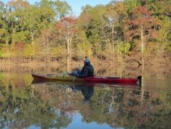
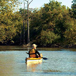
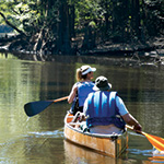
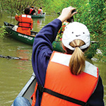
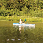
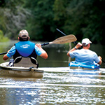
 The landscapes of Louisiana are as diverse and exciting as the people who live here, and one of the best ways to explore the natural beauty is by water. You will find beautiful rivers, bayous, lakes, canals, reservoirs, ponds and marshes scattered throughout the state. These waterways afford excellent opportunities for canoeing or kayaking through our natural landscapes and learning about the native vegetation and wildlife as you go.
Paddling Community
Outfitters
Canoe and Kayak Rentals
LDA Interactive Paddle Trails Map
*NEW* Several of these paddle trails have been added to Google Maps, which can be found at this link.
Brochures of Paddling Trails in Northeast Louisiana
D’Arbonne Country
 Piney forests, rolling hills, five fishing piers and a beautiful lake draw visitors to this quiet, majestic state park. Designed to keep the focus on nature, park facilities blend with the natural landscape to enhance the outdoor experience of this park.
Fishing piers and boat docks attract visitors to Lake D’Arbonne, the marvelous 15,250-acre centerpiece of the park. Recreation on Lake D’Arbonne is tremendously popular among locals and visitors, and record freshwater catches of bass, crappie, catfish and bream make Lake D’Arbonne a fishing haven. Wide open areas of the lake, about seven miles from the park, appeal to water skiers and pleasure boaters. The boat launch at the park opens up all of these opportunities to outdoorsmen.
Tree stands in the lake captivate photographers, as do the towering pines on land and the rich diversity of wildlife and birds that make the park their home. Bring your binoculars and camera to capture the wonders of the natural world from our beautiful nature trails.
Cyclists will enjoy the challenge of the rolling hills of the park as a starting point for biking excursions into the steep inclines and scenic beauty of North Louisiana. Lighted tennis courts add to the activity options available for all visitors. Return for a picnic under the canopy of pine trees and celebrate the magnificence of nature preserved.
Bayou Bartholomew
 Already a designated Scenic and Natural Waterway, the richly endowed Bayou Bartholomew springs from the Arkansas River floodplain hundreds of miles upstream in the middle of Arkansas near Little Rock and flows southward and parallel to the Mississippi River in a bewildering pathway of angular river bends.
It is thought to be the longest bayou in North America (365 miles). In addition, it is the longest undammed waterway on the lower Mississippi River. This fact alone will be of great interest to any paddler, because paddlers know undammed rivers are the wildest and most scenic.
Like most flowing waters of any size in the area, “Da By” (as it’s referred to locally) once provided transportation for the steamboats of the region that plied its waters to reach remote plantations and outposts. Unlike most other waters of the South however, the “By” somehow escaped the zealous river engineering of the past century. As a result, it is a thriving paradise of bankside cypress forests and wildlife. It is the richest fish habitat of any bayou.
Bayou Bartholomew is a classic mixed cypress/hardwood bayou that reaches its most beautiful articulation at the confluence of Chemin-a-Haut, a forest of giant Louisiana bald cypress.
Explore Lake Country
North Louisiana Lake and River Trails
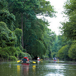
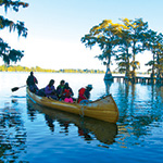 Imagine paddling down long hallways of tall, serene cypress trees, with spanish moss swaying in the breeze. Imagine canoeing or kayaking through a maze of flooded cypress forests and around groups of solemn cypress knees. Where is this watery magic kingdom for paddlers? Along the Mississippi River in northeastern Louisiana!
The lake country of north Louisiana provides a delightful alternative to its rivers and bayous. While paddling the streams is dependent on water levels, the lakes are always good for canoeing, kayaking and stand-up paddleboarding. When the river water is too low or too high, paddlers can always get on the lakes. While the rivers present snags, strainers, deep muddy banks, occasional trash and infrequent blockages, the lakes are always wide open and full of sparkling clean water. Water clarity and quality varies from lake to lake, but in general, the lakes of north Louisiana are deep, clear and clean.
If this sounds too perfect to be true, here’s the drawback: The lakes are surrounded by houses and during the summer months are filled with boaters. Paddlers have to share the water with water skiers, jet boats, party boats, bass boats and johnboats. Regardless of traffic, the lakes are full of wildlife, and paddlers can always find places that no one else can get to. Naturalists of all sorts will enjoy the birds, the fish and the unique solitude of paddling through flooded cypress forests. These Louisiana lake trails have been chosen for the best scenery, quietest places and the most wildlife.
Spring and fall generally are the best times of year for outdoor activity in the south, but these lakes are open year- round and can be enjoyed on almost any day of any season.
It is advised to stay off the lakes during stormy weather and high winds. Check the weather forecast before embarking on any adventure. Severe thunderstorms sweep through this region with dangerous ferocity. Beginners should only paddle on calm days. Moderate and advanced paddlers can try it if the wind is 15 mph or above – but be ready for strenuous paddling and waves. All paddlers should stay off the lakes if the wind is gusting to 25 mph or above. Cold weather paddlers should dress in wetsuits or drysuits and also be able to self-rescue in case of capsize. Hypothermia is always a danger between November and April. In the event of strong winds, choose a route with protection from the wind, like a line of trees along one shore or the other.
The paddling trails are daytrips only, and arrangements for lodging will need to be made at any number of nearby campgrounds (like Lake Bruin State Park), lakeside hotels (like Lake Bruin Lodge or Spokane Resort) and cabins (like Netterville cabins).
Lower Mississippi River National Wildlife Refuges
 The Lower Mississippi River Refuge Complex includes St. Catherine Creek, Bayou Cocodrie
and Cat Island National Wildlife Refuges. All three are within 5 miles of the Mississippi River. From loess bluffs to cypress swamps, each refuge has its own unique landscape. These lands were set aside
to allow our nation’s wildlife to thrive, but, you can experience the refuges by hiking or paddling on designated trails listed in this brochure. Both activities offer a safe way to learn and observe nature in the Miss-Lou area. All trail distances are round trip unless stated otherwise.
Bayou Macon
 In this section of the Bayou Macon, the landscape subtly changes as the Macon Ridge becomes less prominent and the forest becomes drier and thicker with locusts, sycamores, cottonwoods and willows. Some of the land is used for grazing cattle. Some tallow trees are found along the banks, and more and more swamp-like vegetation can be seen from the canoe.
Continuing down the bayou past the boat ramp, the river opens up noticeably, and the current lessens, partly due to some dredging and channelization done in the 1960s. You will start seeing more and more waders – the water-loving class of birds that includes white pelicans, herons, egrets, storks, roseate spoonbills and anhinga. Bald eagles have been sighted here, as well as osprey and harriers.
As you paddle along, watch carefully for old oxbows of the Bayou Macon that were isolated during channelization.
At most water levels you can paddle into one of these lakes for a view of classic Deep South scenery – Spanish moss draped cypress trees full of egrets and waters thick with turtles, snakes and that most famous of all southern amphibians, the American alligator.
Big gators have been seen in these oxbows. (Caution: Children especially should stay in their vessels. Watch your pets, if you are carrying any.) You will pass four oxbows, one at mile 13.5, one at 14.1, one at 14.7 and the last at 16.1. The first and last are accessible from the river at medium to high water levels, but the middle two have been incorporated into the Poverty Point Lake and cut off by the levee.
Along a wooded bend of the river at mile 15.5 you will paddle past the four cabins of Poverty Point Reservoir State Park that overlook the Bayou Macon. These cabins can be rented but they are popular sites, so make your reservations well in advance.
Other constructed landmarks in this section of the bayou include a high-voltage transmission line (mile 15.9), an oil pipeline, a natural gas pipeline and several openings through the woods on the west bank where you could clamber up the levee and get a view across the reservoir.
Paddling around the last bend in this section at mile 18 you will see the Highway 80 bridge downstream and should start making plans for your final approach. Beware: There is a dangerous weir not far below this take-out. The boat ramp is under the bridge to your right (west bank). You will see a stout pier sticking out into the channel that you can tie your vessel to if you don’t want to run it up the ramp.
The Highway 80 boat ramp is a steep concrete ramp and always accessible. Beware there is a low-head dam 200 yards downstream. This ramp is located within the Delhi City Park on the eastern edge of town. Camping is OK with permission but not recommended. The best choice for camping is at Poverty Point Reservoir State Park.
Tensas River
 There is no quieter way to get close to nature than from a paddle-powered craft such as a canoe or kayak, and nowhere is this more rewarding than in the depths of the Tensas River National Wildlife Refuge. The possibilities for paddlers on the Tensas River and adjacent bayous, backwaters and tributaries are almost endless. The very best choice, we feel, is the route from Fool River Boat Launch to Ben Lilly Boat Launch.
Tensas River National Wildlife Refuge
 The Tensas River creates a natural wonderland of big trees and spectacular wildlife through the middle of northeast Louisiana. The Tensas is legendary for its natural history of red wolves, Florida panthers, ivory-billed woodpeckers and Louisiana black bears. Unfortunately, out of that list, only the black bear remains.
The best way to experience the natural wonders of the Tensas River is by canoe, kayak or pirogue. Paddlers will be humbled by giant cypress trees and thrilled with birding, flourishing flora, frequent turtle and gator sightings and many signs of the Louisiana black bear. During winter, bald eagles may be sighted.
The Tensas River flows out of Lake Providence and meanders south before it descends into the expansive woods of the Tensas River National Wildlife Refuge.
On a map you will notice graceful loops, which begin in small radial turns and then grow in size as the river coils into giant loops that are actually ancient channels originally carved by the violent floods of the Mississippi. You will be amazed by the directional changes as you make your way down. In one section, the river channel loops around 20 miles to make 2 miles of southerly gain!
Two trails are on lakes that inhabit old channels of the Tensas that have been isolated by the changing nature of the river and are now charming still water pools ringed by deep forests drenched with the aroma of cypress/hardwood forests.
The visitor’s center at Tensas River National Wildlife Refuge should be your first stop before embarking on any water travel inside the refuge. Consult someone at the main desk for permits and information about current water conditions and landings.
Paddling the Mississippi River Tributaries
 Although you won’t find much white water in Mississippi or Louisiana, you will encounter some beautiful scenery and plentiful wildlife while paddling our waterways. Many creeks, streams, bayous and rivers in both the Mississippi and Louisiana deltas are lined by deep woods that are home to a variety of plant and animal life. Birding from . . .
The River Gator
 The River Gator is an online tool developed by John Ruskey owner and operator of Quapaw Canoe Company in Clarkesdale, MS. Ruskey frequently travels the Mississippi River and on this site he has included information and links to provide a completely integrated visit to the mid-south centered around the Mississippi River. Good supporting land conveniences and services such as food, accommodations and groceries are included as well as destinations like the Delta Cultural Center and the Delta Blues Museum are found in the towns and cities along the Mississippi River Trail. Click here to start your travels.